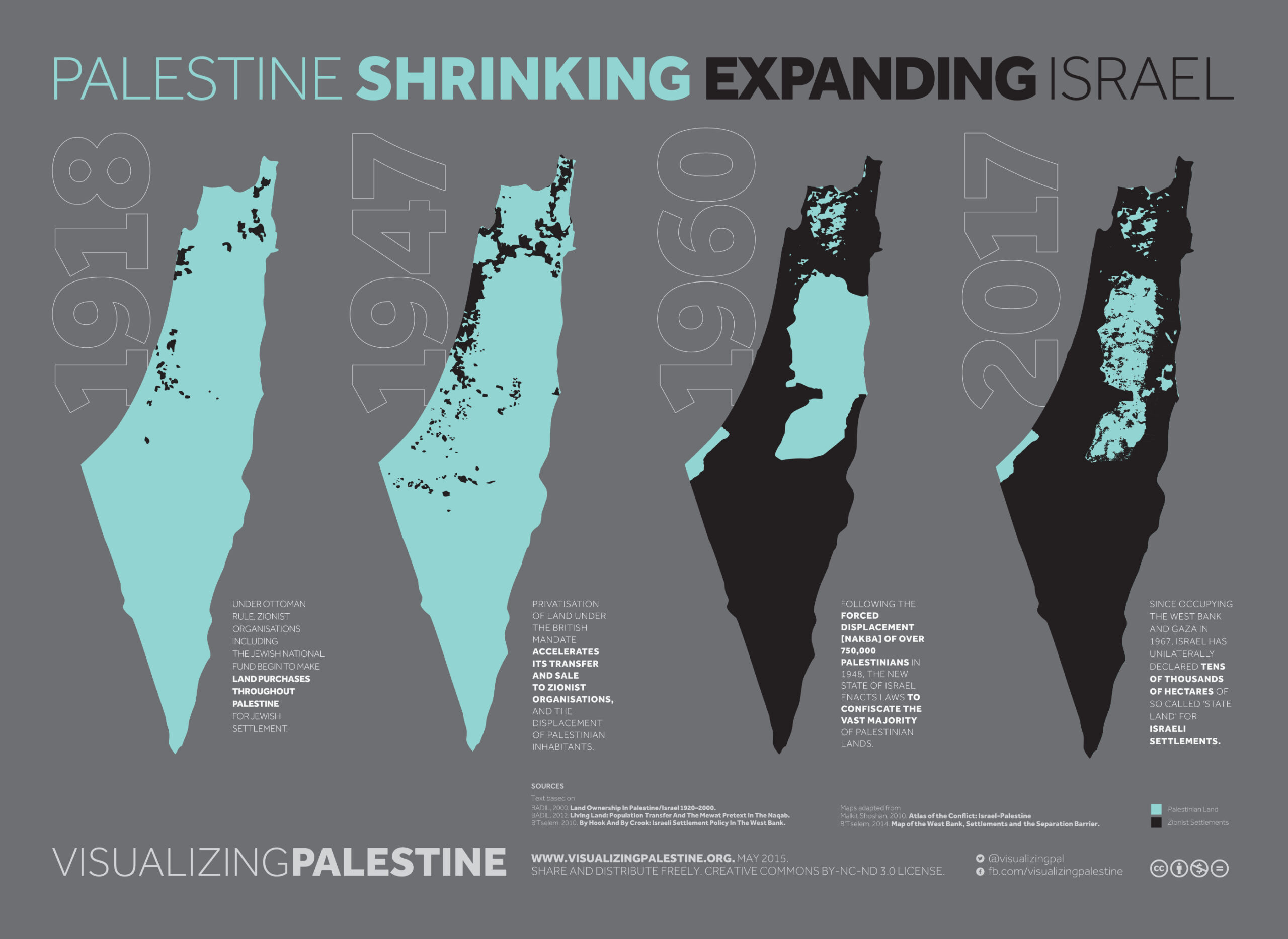
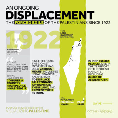
‘Shrinking Palestine’ describes the military, legal and financial tools that have been utilised by the Zionist movement over the past century to acquire Palestinian land, and maps the gradual and ongoing fragmentation of historic Palestine and the exclusion of Palestinians from living in most of their homeland.
Prior to 1948, the black areas denote the land purchased by Jewish individuals and organisations, foremost the Jewish National Fund (JNF), amounting to less than 5% of historic Palestine in total. Post-1948, the black areas within 1948 Palestine refer to land administered by the Israel Lands Authority, the vast majority of which has been expropriated from Palestinian landowners. In the West Bank, the state has used an obscure Ottoman law to declare around a quarter of the territory as ‘state land.’
The end result is that Palestinians are largely excluded from living in the vast majority of their homeland.